Some U.S. routes do more than connect towns. They raise the stakes with high passes, remote gaps between services, and scenery that changes fast enough to feel scripted. This list focuses on drives where the road itself creates tension: cliff edges, alpine weather, wildlife crossings, and open water exposure. Each trip has clear geographic anchors and real constraints that make the journey feel like an adventure film. Plan like a producer: timing, fuel, and conditions matter.
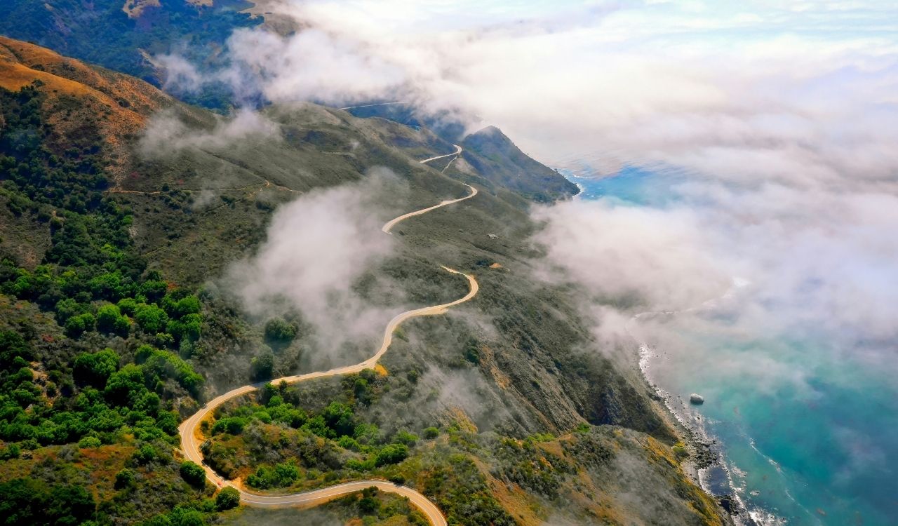
1. Pacific Coast Highway, California
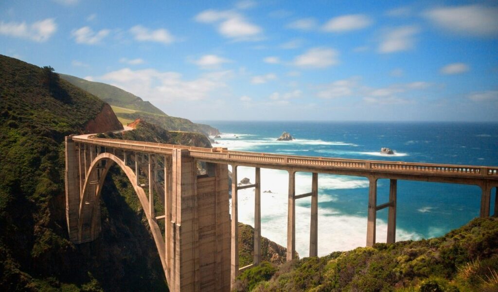
California’s Highway 1 turns into a high-drama route along the Big Sur coast, where steep drop-offs and tight curves keep speeds low. Key viewpoints like Bixby Creek Bridge sit above cliff terrain, and shoulder space can be limited. Rockslides and storm damage periodically close segments, so detours may add hours. Cell coverage can be unreliable in pockets, and pullouts fill quickly on summer weekends. The constant edge driving and changeable conditions create a true adventure-film rhythm. The most cinematic stretch runs roughly between San Simeon and Carmel, where two-lane sections can pinch into one-lane traffic during repairs.
2. Going-to-the-Sun Road, Montana
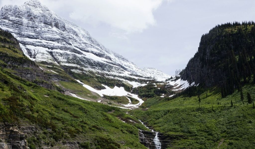
Going-to-the-Sun Road is the only road that crosses Glacier National Park, topping out at Logan Pass at 6,646 feet on the Continental Divide. Hairpin turns, narrow lanes, and rock overhangs create real driving pressure, not just scenery. The Park Service restricts oversized vehicles on the highest segment, so travelers in long RVs may need alternate routes. Snow and construction can shorten the season, and timed entry rules may apply in peak months. Wildlife on the shoulders adds another variable. Speed limits drop to 25 mph in the steeper alpine sections, and stops at pullouts can back up traffic quickly on July and August days.
3. Alaska Highway, Alaska, to Yukon
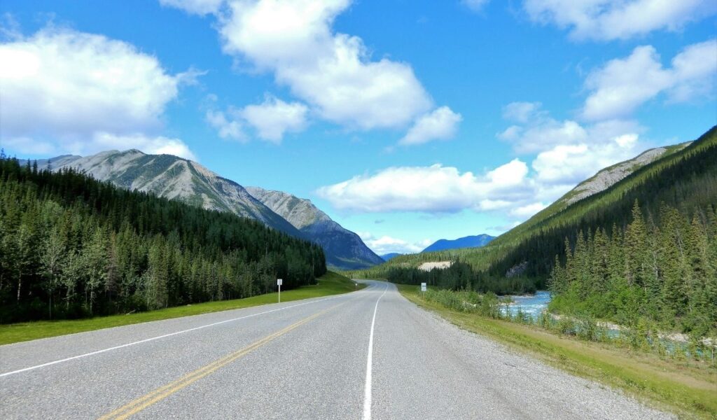
The Alaska Highway runs about 1,390 miles from Dawson Creek, British Columbia, to Delta Junction, Alaska, and the spacing between services is part of the plot. It is paved end to end, yet frost heaves, construction zones, and short gravel sections can still slow travel. Bison and moose crossings are common, so night driving increases risk. North of Fort Nelson, grades can reach 10 percent near Summit Pass at about 4,250 feet. Carry a full-size spare and plan fuel stops, because long gaps can turn a small delay into a serious setback. The weather can flip within hours, and a July snow squall is not impossible in higher stretches.
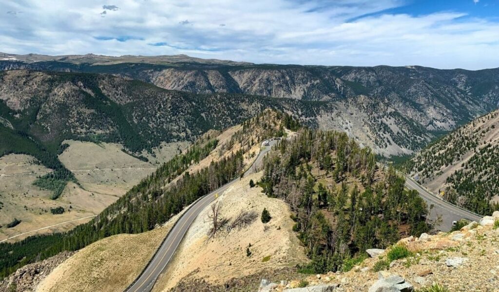
4. Trail Ridge Road, Colorado
Trail Ridge Road carries U.S. 34 for 48 miles through Rocky Mountain National Park and reaches 12,183 feet, the highest continuous paved road in the United States. Above treeline, wind and low visibility can arrive fast, so the route rewards early starts and conservative speed. The high section often closes from October to May, and even in summer, afternoon storms can force quick plan changes. Thin air can affect drivers and passengers not acclimated. With long drop-offs, tight curves, and limited pullouts near the crest, it plays like a summit crossing. It crosses the Continental Divide at Milner Pass, 10,758 feet, then climbs higher.
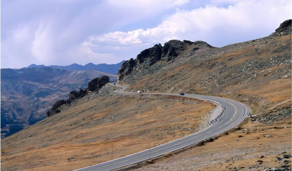
5. Beartooth Highway, Montana, to Wyoming
The Beartooth Highway follows U.S. 212 for about 68.7 miles between Red Lodge, Montana, and Yellowstone’s Northeast Entrance. It crests at Beartooth Pass at 10,947 feet, and the top is typically accessible only from mid-May to mid-October. A key segment gains roughly 5,700 feet in about 12 miles, putting real demand on brakes and cooling. Above treeline, wind, glare, and sudden snow can reduce control fast. With few services near the summit, the drive carries the pressure of an alpine expedition. Tight switchbacks limit passing, and pullouts can be scarce, so drivers must commit to steady pacing and careful lane discipline.
6. Overseas Highway, Florida Keys
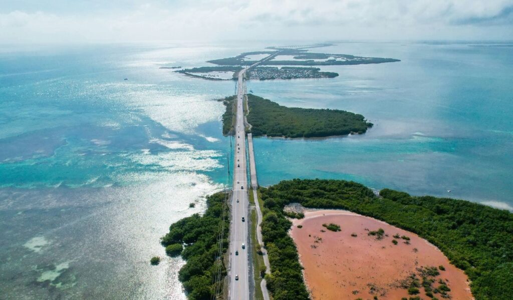
The Overseas Highway runs about 113 miles across the Florida Keys on U.S. 1, linking islands by bridges over open water. Its signature span, the Seven Mile Bridge, is about 6.79 miles between Knight’s Key and Little Duck Key. Ocean exposure brings crosswinds, glare, and sudden squalls that can cut visibility fast. Traffic stays on a single corridor, so crashes or road work can trigger long backups. Near the center, the bridge rises to about 65 feet for boat clearance, and the shoulders stay limited for stops. During hurricane season, June through November, forecast checks matter because water over the road and closures can arrive quickly.