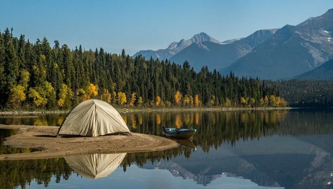
Colorado is home to some of the most spectacular terrain in North America, boasting 58 peaks over 14,000 feet and thousands of miles of trails. In 2026, the state’s outdoor industry continues to see high demand, with many popular trailheads now utilizing permit systems to preserve fragile alpine ecosystems. According to recent 2026 trail status reports, hikers are encouraged to check for seasonal closures and timed entry requirements before heading to the mountains. This article highlights five premier trails that offer a factual cross-section of Colorado’s diverse beauty, from red rock canyons to electric-blue glacial lakes. We analyzed difficulty ratings, distance, and current permit data to help you plan an unforgettable trek through the Rockies.
Maroon Bells Scenic Loop (Aspen)
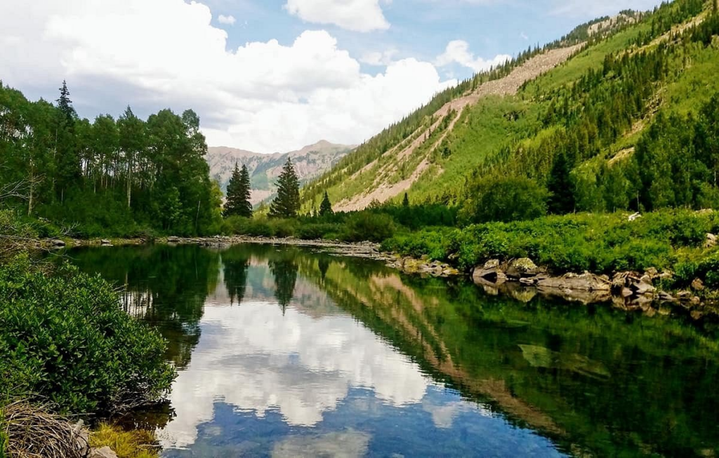
The Maroon Bells are famously cited as the most photographed peaks in North America, featuring two massive “bells” reflected in the pristine Maroon Lake. In 2026, visitors must secure a parking or shuttle reservation through the Aspen Chamber of Commerce to access the scenic area during the peak summer and fall months. The Scenic Loop is an easy, 1.9-mile trail that provides world-class views with minimal elevation gain, making it accessible for families and casual hikers. According to forest service data, the area is especially popular in late September when the surrounding aspen groves turn a brilliant gold. For those seeking more challenge, the nearby Crater Lake Trail offers a moderate 3.6-mile round-trip extension that leads directly to the base of the peaks.
Sky Pond via Glacier Gorge (Rocky Mountain National Park)
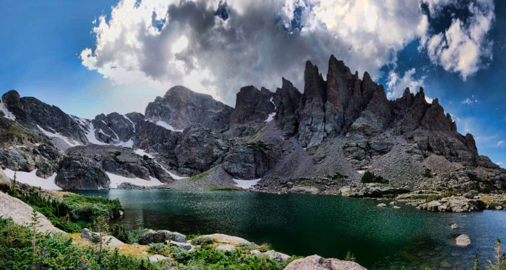
Sky Pond is a quintessential Colorado alpine adventure that takes hikers past three distinct waterfalls and two high-altitude lakes before reaching a dramatic glacial basin. According to 2026 National Park Service guidelines, hikers must secure a “Timed Entry+ Bear Lake Road” reservation to access the trailhead between late May and mid-October. This strenuous 9-mile trek features a thrilling scramble up the side of Timberline Falls, which requires a steady hand and a lack of fear regarding heights. The final destination is a stunning pond surrounded by jagged spires known as “The Sharkstooth,” providing a rugged landscape that feels truly remote. It is widely considered one of the most rewarding day hikes in the park due to the high density of scenic landmarks along a single path.
Hanging Lake Trail (Glenwood Canyon)
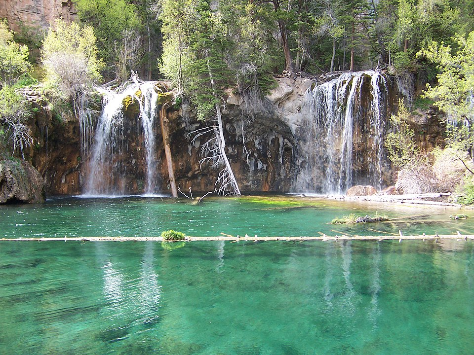
Hanging Lake is a rare geological wonder featuring a turquoise lake perched on the edge of a cliff, fed by the delicate Bridal Veil Falls. Because the lake’s ecosystem is extremely fragile, the Forest Service strictly prohibits swimming or walking on the fallen trees within the water to prevent the introduction of harmful oils and bacteria. In 2026, a permit is required for all hikers, with prices typically ranging from $10 to $12 depending on the season. The trail is short at just under 3 miles round-trip but is remarkably steep, gaining over 1,000 feet in elevation as it follows a rocky canyon floor. The recent trail redesign projects have improved the path’s stability, ensuring that this National Natural Landmark remains a top-tier destination for decades to come.
Ice Lakes Trail (Silverton)
Located deep in the San Juan Mountains, the Ice Lakes Trail leads hikers to two of the most vibrantly blue lakes in the world, surrounded by wildflower-filled basins. This challenging 7.5-mile hike starts at nearly 10,000 feet and climbs steadily to the Upper Ice Lake basin at over 12,000 feet. According to recent 2026 traveler feedback, the “electric blue” color of the water is a result of glacial flour finely ground rock particles, reflecting sunlight in the deep mountain pools. Many hikers choose to add an extra mile to visit the nearby Island Lake, which features a small, rocky outcropping in its center. The high elevation of this trail means that hikers should be well-acclimated to the thin air and prepared for sudden afternoon thunderstorms that are common in the San Juans.
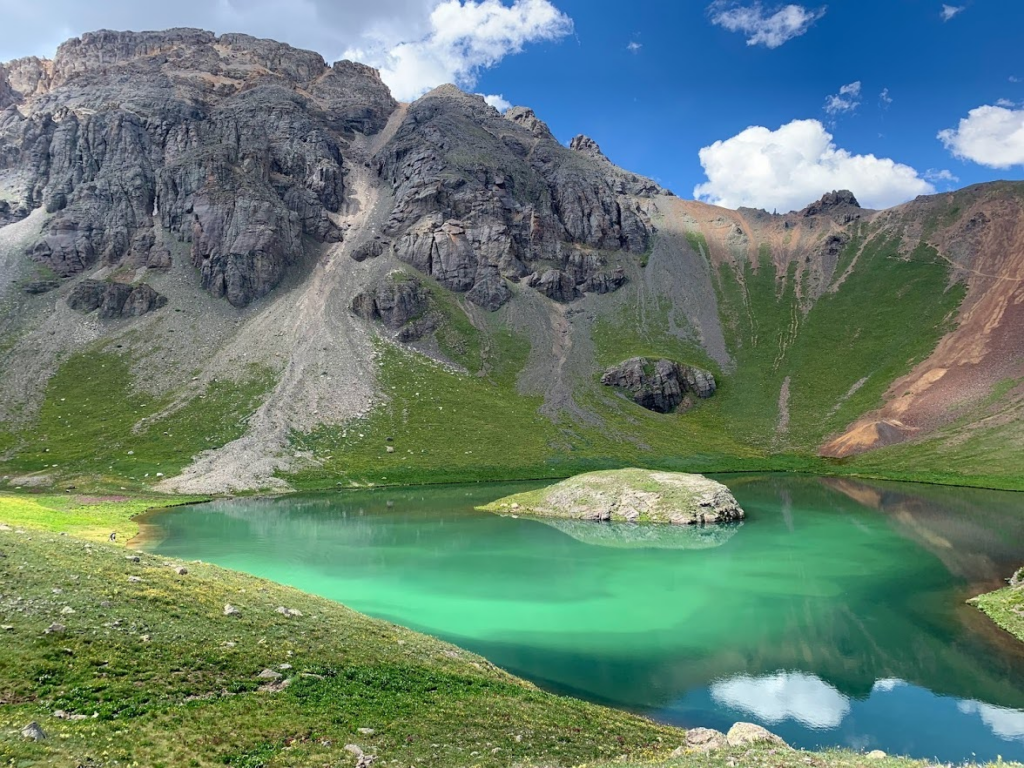
Blue Lakes Trail (Ridgway)
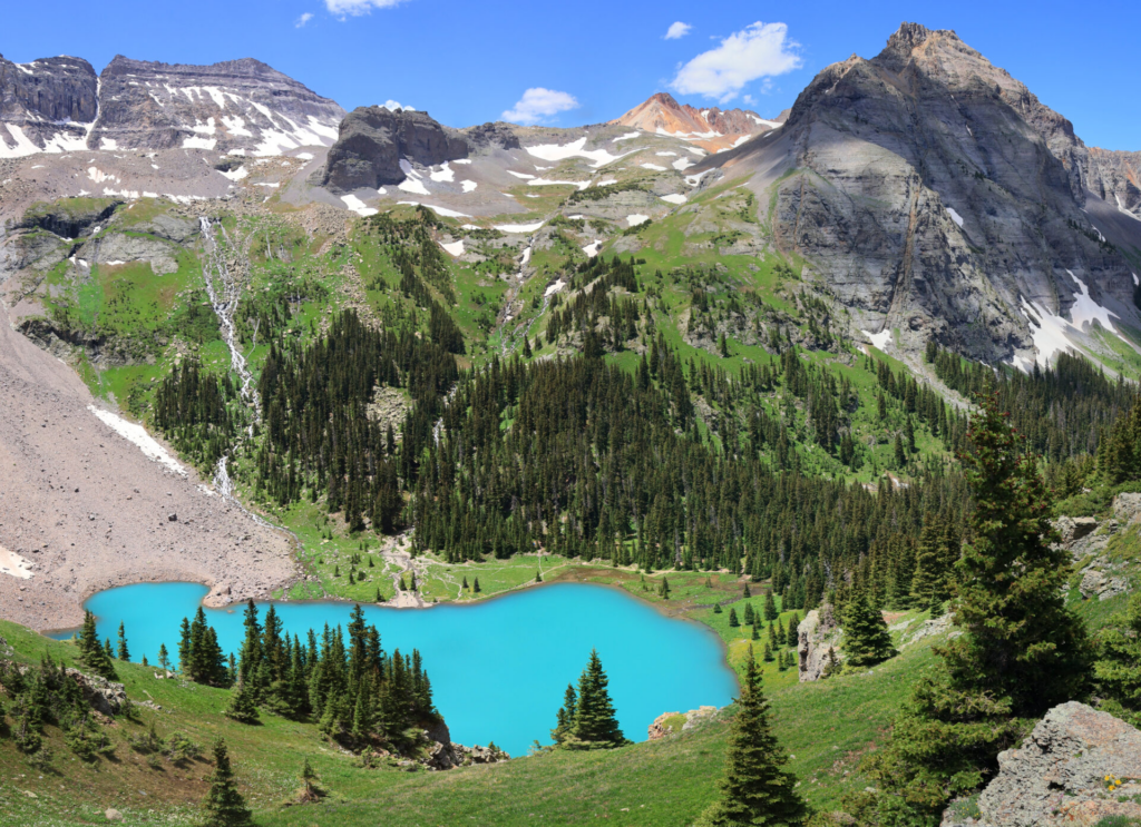
The Blue Lakes Trail is a stunning route in the Mount Sneffels Wilderness that features three distinct alpine lakes stacked like a staircase beneath 14,000-foot peaks. As of 2026, the Forest Service has implemented a new permit system for this area to manage its extreme popularity and protect the surrounding meadows from erosiosjman. The hike to the Lower Blue Lake is a moderate 6.3-mile round-trip, while continuing to the upper lakes and Blue Lakes Pass increases the total distance to nearly 11 miles. According to ecological reports, the lower lake is the largest and is famous for its deep, sapphire-blue hue that contrasts beautifully with the rust-colored ridges above. It is a premier spot for backcountry camping, provided you follow “Leave No Trace” principles and secure the necessary wilderness permits in advance.