
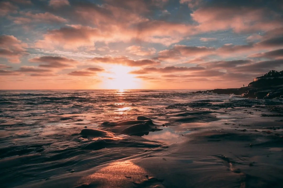
One of the most epic hikes in California with jaw-dropping alpine lake views is the Big Pine Lakes Trail.
While some will choose to make this into a backpacking trip, you can hike to all seven lakes in one day if you are a skilled hiker and acclimated to the elevation.
You will have to hike uphill for 4.5 miles over 2,150 feet of elevation before you even start to see the first alpine lake. From there, it’s another uphill climb for 4 miles to see all 7 lakes.
BIG PINE LAKES TRAIL
-
Distance | 16 miles roundtrip
-
Elevation Gain | 3450 ft
-
Average Hiking Time | 10 hr
-
Best Time to Visit | June-September
Whether you fly or drive, you will need to arrive in Big Pine, CA.
From Big Pine, you will head West on Crocker Ave as it turns into Glacier Lodge Road.
Continue on Glacier Lodge Rd as you wind up the mountain for 9.5 miles where you will find the overnight and day-use only parking lots for Big Pine Lakes Trail.
The 2 major airports closest to Big Pine, CA are:
-
Bakersfield Regional Airport: 211 miles, 3 hours and 10 minutes South of Big Pine, CA
-
Reno-Tahoe International Airport: 217 miles, 3 hours and 40 minutes North of Big Pine, CA

Trailhead Parking
There are 2 parking lots for Big Pine Lakes trailhead:
-
Backpackers: you will want to park at the Big Pine Creek Overnight Parking located at (37.12813, -118.427762)
-
Day Hikers: If you plan to park only for the day you can drive another half mile up the road, past Big Pine Creek Campground, and park at the lot located at (37.12539, -118.43751)
You do not need a parking permit or forest pass to park in either of these lots.
You only need a permit to hike Big Pine Lakes Trail if you plan to camp overnight along the trail or in the Inyo National Forest.
Day hikers do not need a trail permit!
For those of you wanting to camp overnight in the Inyo National Forest, you will need to obtain a wilderness permit from recreation.gov.
There is a quota for wilderness permits, allowing only 25 people per day during the peak season: May 1st through November 1st.
During peak season, rec.gov allows 60% of the quota to be reserved up to 6 months in advance and the remaining 40% can be reserved up to 2 weeks in advance.
Ideally, the best time to hike Big Pine Lakes is during summer (June to September) when most of the snow has melted from the trail.
We went mid-May and could only make it to Fifth Lake before we needed crampons to get through the snow and ice.
During July and August, the Big Pine Lakes Trail has thawed out and is clear enough to get to all seven lakes. Keep in mind mosquitoes come out strong in early June and last until August.
If winter hasn’t come early, October is also a great time to hike here. You will have even fewer crowds than in the summer, but you will need to dress for cooler temps.
Due to heavy snowfall in the Eastern Sierras, it is not advised to hike this trail from December to April as it is extremely difficult with harsh conditions.

-
Service is non-existent. Download the town of Big Pine from Google Maps and the hiking route from All Trails.
-
You will need to acclimate to the high elevation at least 1-2 days if you are coming from lower than 5,000 feet. The hike starts at 8,000 feet.
-
Plan to drink 3-4 liters of water per person for the day hike.
-
Only dogs with experience hiking 10+ miles in high elevation should hike this trail, as it is very difficult and the rocky terrain is rough on their paws.
-
Tell a responsible person where you are going AND when you plan to be back, in case of an emergency.
-
Always refer to the local ranger station to clarify any questions you may have. White Mountain Ranger Station: (760) 873-2500
Big Pine Lakes Distances —
If you plan to hike Big Pine Lakes Trail in one day and don’t plan to stay overnight, make sure you get to the day-use parking lot by 9am.
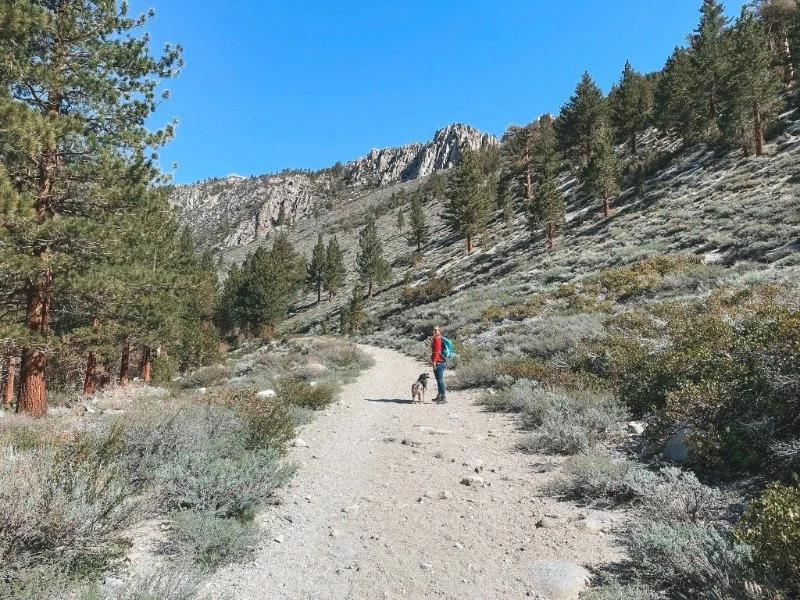
Also, the beginning of the trail is exposed and gets very hot so it’s best to start this trail early. The first half mile is composed of frequent tight switchbacks along the high-flowing North Fork Creek.
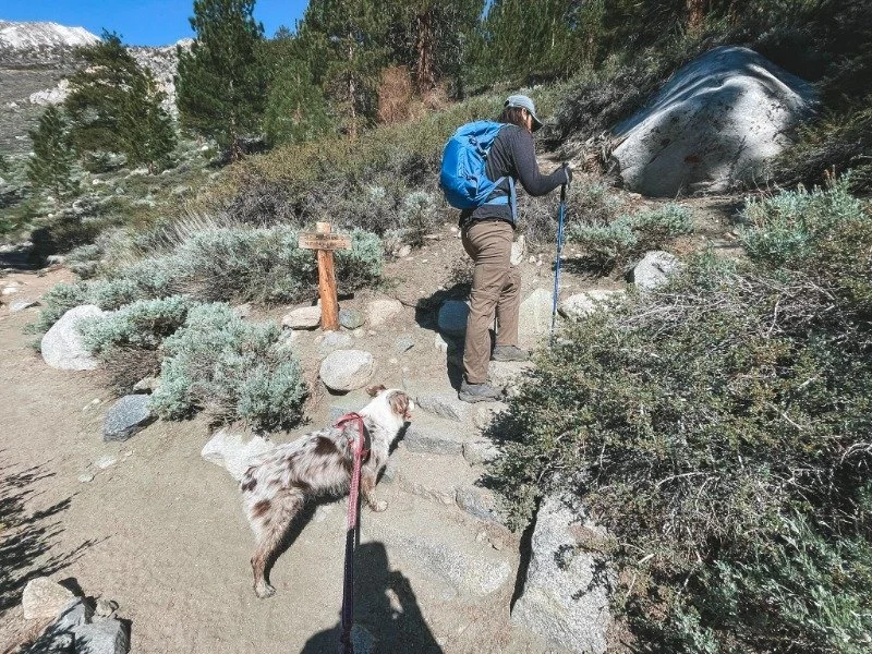
There are also a few forks during this first stretch that split off from the North Fork Trail, pay attention to the trail signs to stay on the “NF Trail” route.
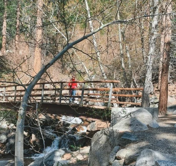
Around 0.7 miles, you will cross the North Fork Creek on a picturesque bridge with a waterfall flowing in the back.
From here the hike continues along the North Fork Creek where the trail starts to become exposed and the views of Cienega Mirth peaking out from behind the lush mountain top.
Cue the next set of long, exposed switchbacks.
As you traverse up these switchbacks toward the lush forest (that will definitely be your guiding beacon) you will probably start shedding some layers at this point.
Around 1.5 miles, you will meet up with the backpacker’s route along the North Fork trail.
Once you’ve finally made up those never-ending switchbacks (~2 mile marker), you will be treated to a beautiful waterfall.
And, of course, more incline but at least this time it is mostly shaded and the high-flowing creek is beautiful!
Around mile 2.7 you will come across the Wilderness Ranger Camp Building, or as some call it the Lon Chaney Cabin.
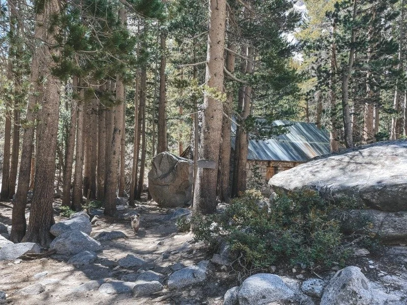
If you need a rest break, this is a great area to do so as it is shaded and the flowing creek in front of the cabin is quite peaceful.
The trail continues uphill but thankfully it is more shaded than the previous mile.
You will have a few creek crossings if you hike the trail earlier in the season, but it shouldn’t be deep enough to soak your shoes.
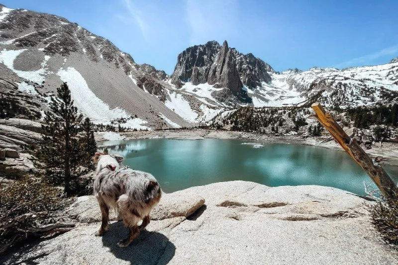
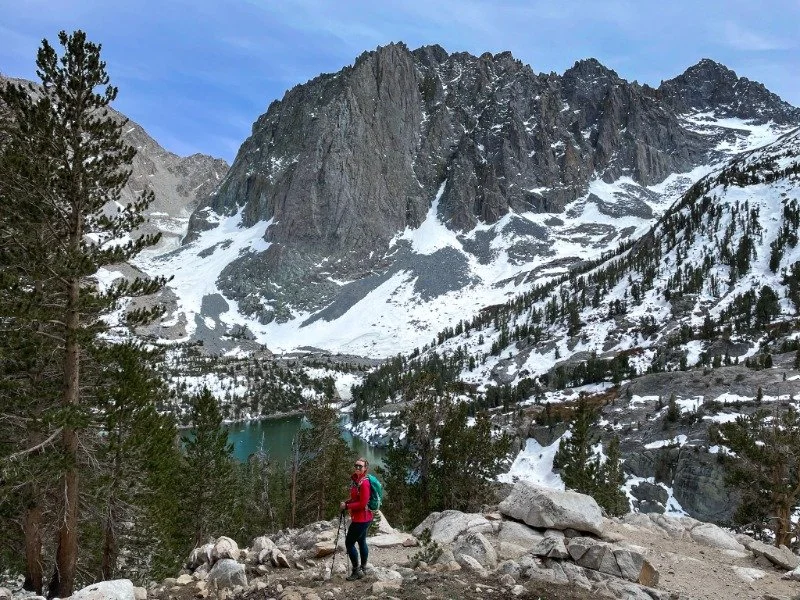
As you finally make it to 4.5 miles you will start to see the First Lake downhill to your left!
Cue epic photo #1:

The First Lake is absolutely stunning! The turquoise water pops in front of the granite mountains.
You could scramble downhill to get to the shoreline but don’t forget you have quite a ways to go and there will be easier lakes to get into if you’re up for a cold plunge!
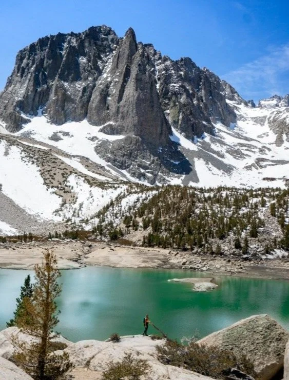
As you continue along the trail, very shortly after you will be rewarded with aerial views of Second Lake.
Second Lake is most people’s favorite lake, especially for sunrise, as Temple Crag in the background makes for an epic alpine glow.

This is also the most common place backpackers choose to set up camp as they explore further without all the weight.
If you can push it another 0.7 miles I recommend getting to the Third Lake before taking a long rest or meal break.
Most people don’t continue past the Second Lake and I think the views from Third Lake are even better as the lake is higher and you still can see Temple Crag in the back.
There is also a lot more shade around the Third Lake so you can relax and take a break out of the sun.
The Temple Crag is a popular peak for experienced climbers. It isn’t for the faint of heart though as the peak sits at 12,982 feet.
Once you’re ready to continue on the trail, you’ll hike another mile uphill where you will cross into 10,000 feet of elevation.
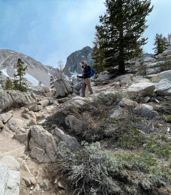
Even those coming from acclimated to high elevation will admit they tend to hike at a slower pace once this high in elevation so don’t feel bad if you need to take a few more breaks or go at a slower pace.
Right around mile 6.3, you will come to a split in the trail, there is a sign nailed to a tree showing that you can either go left towards the Fifth Lake or right towards Fourth Lake.
If you don’t see snow on the trail yet, then chances are you can easily do the loop around to see both lakes.
When we hiked on May 12th, the snow was so deep between Fourth and Fifth Lake that we had to go out and back from the original fork in the trail to see both, we could not do the loop.

Nor could we hike the yellow route (pictured above) around Fourth Lake to see Black Lake.
Most hikers on this trail say by mid-June (most years) the snow is minimal and you can easily hike past Fifth Lake without any crampons and the yellow route shown above is cleared from deep snow.
If you are hiking after July 1 and it isn’t a record snowfall year, I recommend following the red route the way up to Seventh Lake. On the way back, take the yellow route (pictured) to see the expansive mountainous views from Black Lake.
You will also shave off a mile on this route, but you won’t see Lakes 1-3 again on the way down.
Fourth Lake doesn’t have as epic a background as most of the other alpine lakes, but it is probably the most peaceful lake.
There are great campsites that come off the peninsula to the south (right side if looking at the picture above).
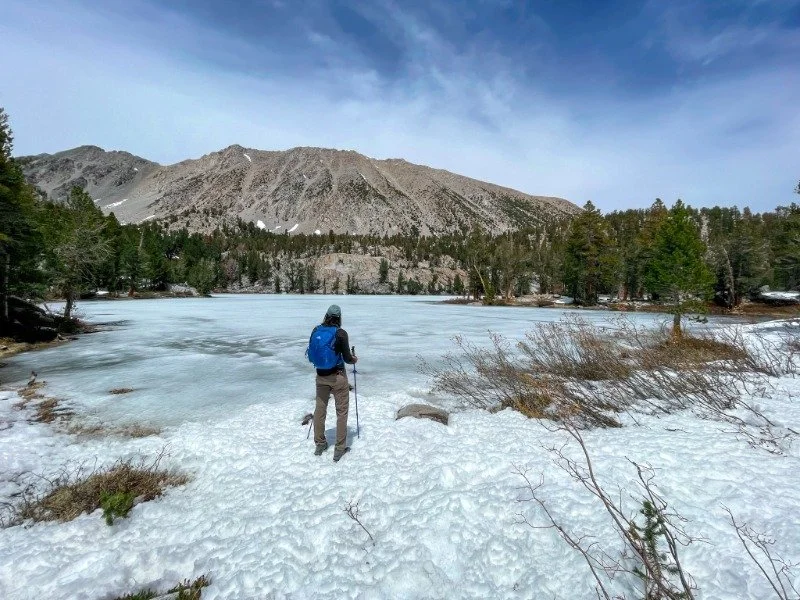
As you can see in the photo, the lake was completely frozen over in mid-May as this lake doesn’t get as much sun as the other alpine lakes.
The most beautiful alpine lake to me is Fifth Lake.

Even though the lake was completely frozen over (we could even walk across it) the deep blue rays casting up through the icy water was something I had never seen before, it was truly mesmerizing.
Since you can easily walk right up to the shoreline, Fifth Lake would be the perfect alpine lake to partake in the cold water plunge. That is, once the lake is unfrozen.
The mountain peaks that tower behind Fifth Lake are Two Eagle Peak standing at 12,980 feet and Mt. Robinson standing at 12,963 feet.

If the trail isn’t covered in snow and you have the energy to keep trekking, you will have less than 2 miles to get to Sixth and Seventh Lake!
As you can see from the pictures the snow eventually got too deep and we had to turn around just after the Fifth Lake.

As much as we wanted to press on, we had to be honest with the situation and what was safest for us and our dog.
In the end, I can say seeing FIVE alpine lakes on one hike was legendary enough for me and I know we will be back again to do this as a backpacking trip!
Who wants to join?!
For an overnight trip, we’d probably camp at Third Lake and do a day hike to Seventh Lake and then another day hike to the Palisade Glacier.


-
Hiking boots: for the rocky terrain a boot like the Salomon paired with Darn Tough socks is perfect.
-
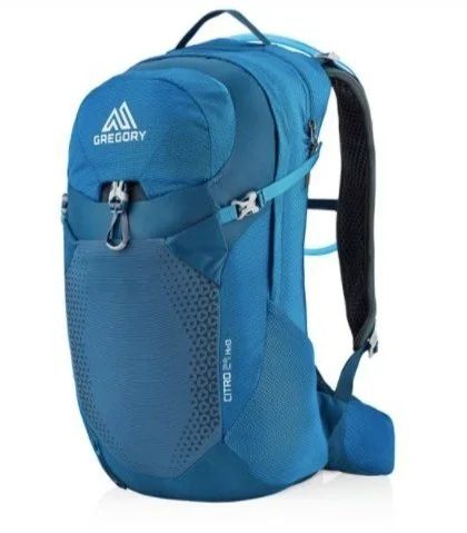
Hydration Pack: a 20-25L pack with 3L of water per person is ideal. His Gregory 25L and her Osprey 20L backpacks are our favorite
-
Electrolytes: we swear by this no-sugar electrolyte mix to help prevent dehydration
-
Trekking Poles: these poles are of incredible quality for the price
-
Packable jacket: a water-proof jacket like the women’s REI GTX and men’s OR Foray are a must.
-
Sunscreen: the UV rays are intense this high in elevation. Coola is incredibly lightweight and never feels greasy
-
Sun Hat: this is the perfect hiking sunhat
-
Safety Items: ultralight First Aid Kit, a LifeStraw, multi-tool, and a survival blanket.
-
Bug Spray: you don’t want to be without this heavy-duty repellent or this bug net if you’re going in July or August.
-
Food & Snacks: We packed chicken pasta salad for lunch and ate Honey Stingers for quick, clean fuel.
-
Pee Cloth: ladies, this anti-microbial Pee Cloth is a must.
-
Dog Accessories: Our Aussie never goes on a hike without a hiking water bottle, hands-free leash, and no-pull harness.
We use affiliate links for products we recommend and, at no extra cost to you.
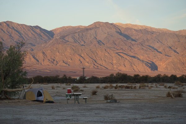
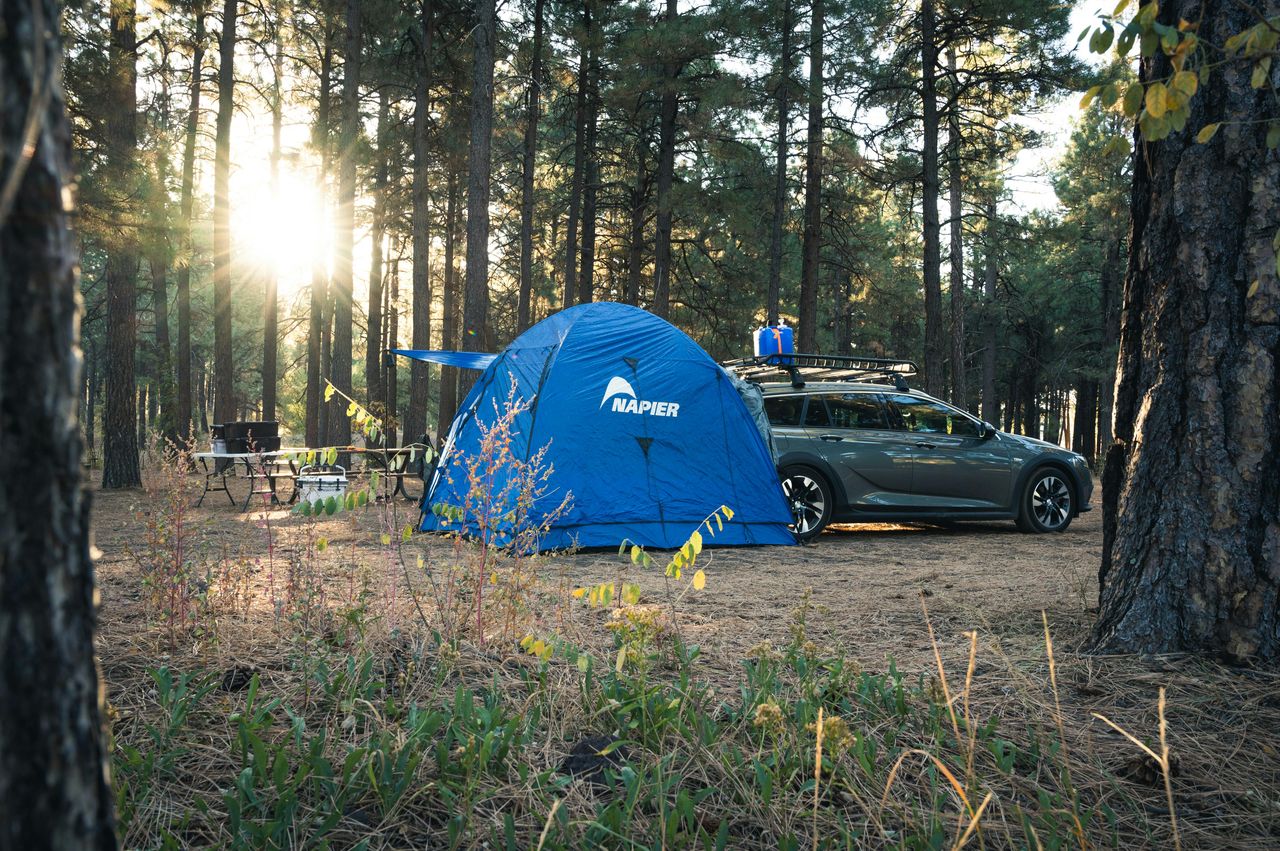
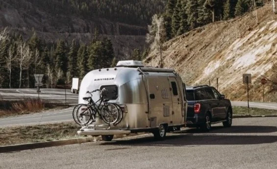
There are two campgrounds within a quarter mile from Big Pine Lakes Trailhead:
-
Big Pine Creek Campground: located steps to the trailhead with 30 tent and RV sites. There is no electricity, water, or cell signal here.
The spots are tight so I wouldn’t recommend larger rigs or new-RVers here, but we did see a 40’ Class A tucked tightly in the trees here. Potable water is available at Sage Flat Camp. -
Glacier Lodge: a quarter mile from the trailhead is this rustic lodge with cabins and RV sites. They also have a general store offering breakfast, lunch, and dinner. Wifi is available for $5 per person per day at the general store.
-
Quality Inn Lone Pine: we stayed here for the week since we also hiked Lone Pike Lake by Whitney Portal and explored the Alabama Hills.
It is the nicest hotel in Lone Pine or Big Pine and we would definitely stay here again. -
Travelodge by Wyndham: located 30 min North of the trailhead in Bishop, CA is a nice hotel if you want to stay in a bigger town with more restaurants and larger chain stores like Von’s.


If you liked this article, please share it!


Hi Taylor! This is so amazing thanks for the blog. Couple of questions for hiking Big Pine in October- do you recommend cramp ons? Also- we plan on hiking Big Pines (goal for all 7 lakes but can turn around if tired) in one day. Do you recommend getting there a day earlier to do smaller hikes to adjust to the elevation/altitude?
Hi Syd, I would recommend calling the forest rangers in that area once you’re a week and even a day out from your hike to see if they recommend crampons since you’re going on the cusp of the season.
And yes, I do recommend getting there at least a day early to adjust if you’re coming from lower elevation. We hiked Lone Pine Lake along the Whitney Portal a couple of days before and it was a great warm-up hike.
I also highly recommend drinking electrolytes like "Key Nutrients" to keep you hydrated and help with elevation sickness. Please email me if you have any more questions. So excited for you to experience this amazing hike!