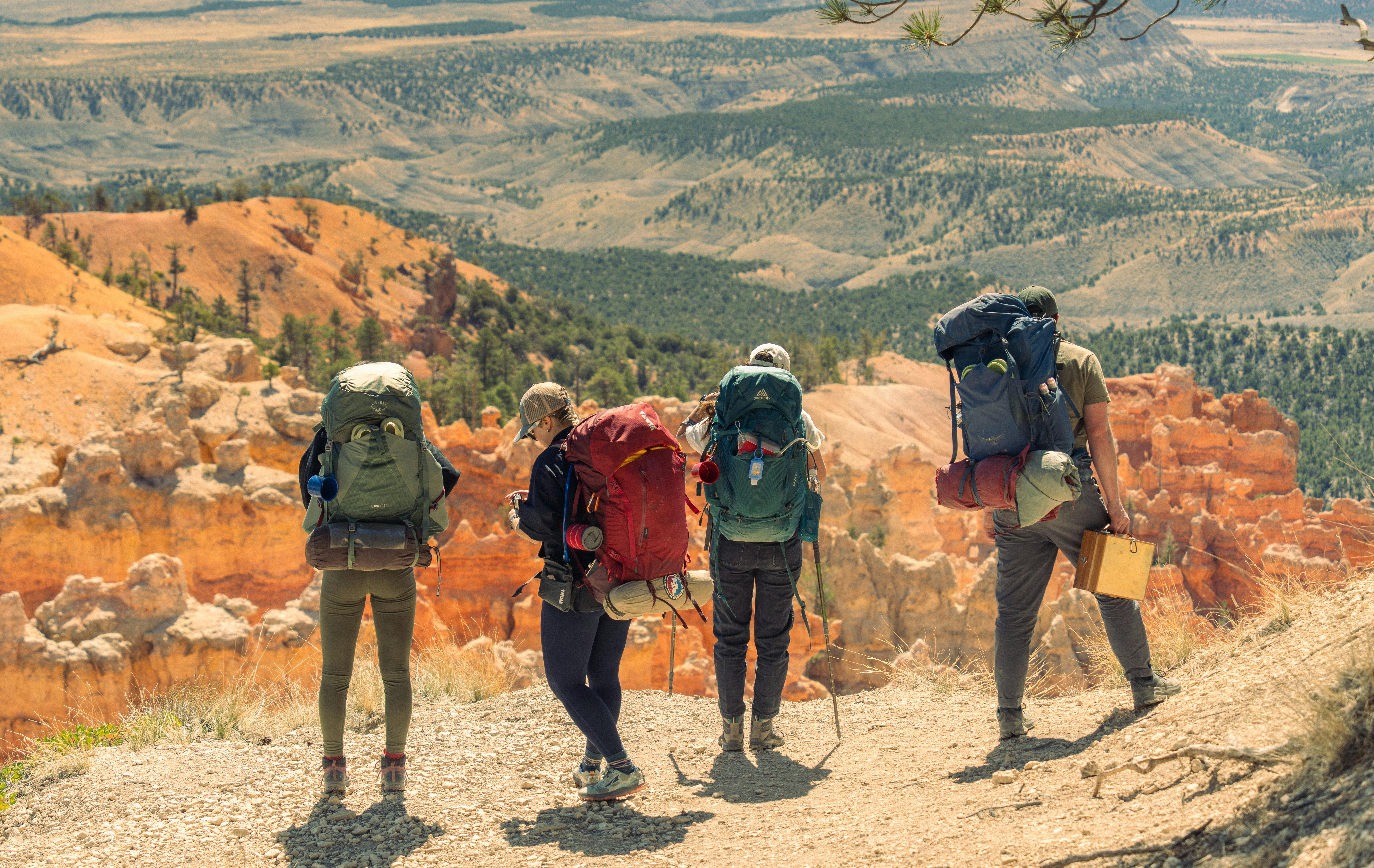
Crowded icon trails are pushing more hikers toward the national forests next door.
Across the West, lesser-known routes managed largely by the U.S. Forest Service are emerging as scenic, practical alternatives to some of the country’s best-known national park hikes.
Why the spotlight is shifting to national forests
The change is being driven by both pressure and access. Major national parks near many headline trails have posted heavy use in recent years, with Yosemite typically drawing about 4 million annual visitors and Grand Teton reaching 3,800,648 recreation visits in 2025, according to the National Park Service. Glacier National Park recorded 2,933,616 recreation visits in 2023, while Zion remains one of the country’s busiest hiking destinations and has relied on a large shuttle system to manage demand.
That congestion has practical consequences. Reservations, trailhead quotas, shuttle waits and parking restrictions can narrow the window for visitors who want a long day hike without a complex logistics plan. In response, forest supervisors and recreation planners have expanded permit systems in high-demand wilderness areas while continuing to promote broader trail networks outside the best-known corridors.
The result is not a hidden outdoors anymore so much as a redistributed one. Trails in national forests often share the same mountain ranges, geology and wildlife habitat as neighboring park routes, but they can offer longer sightlines, looser itineraries and a stronger sense of solitude. For travelers willing to drive a little farther or choose a less familiar name, the payoff can be substantial.
1. Ptarmigan Ridge, Washington, over Mount Rainier’s busier postcard walks
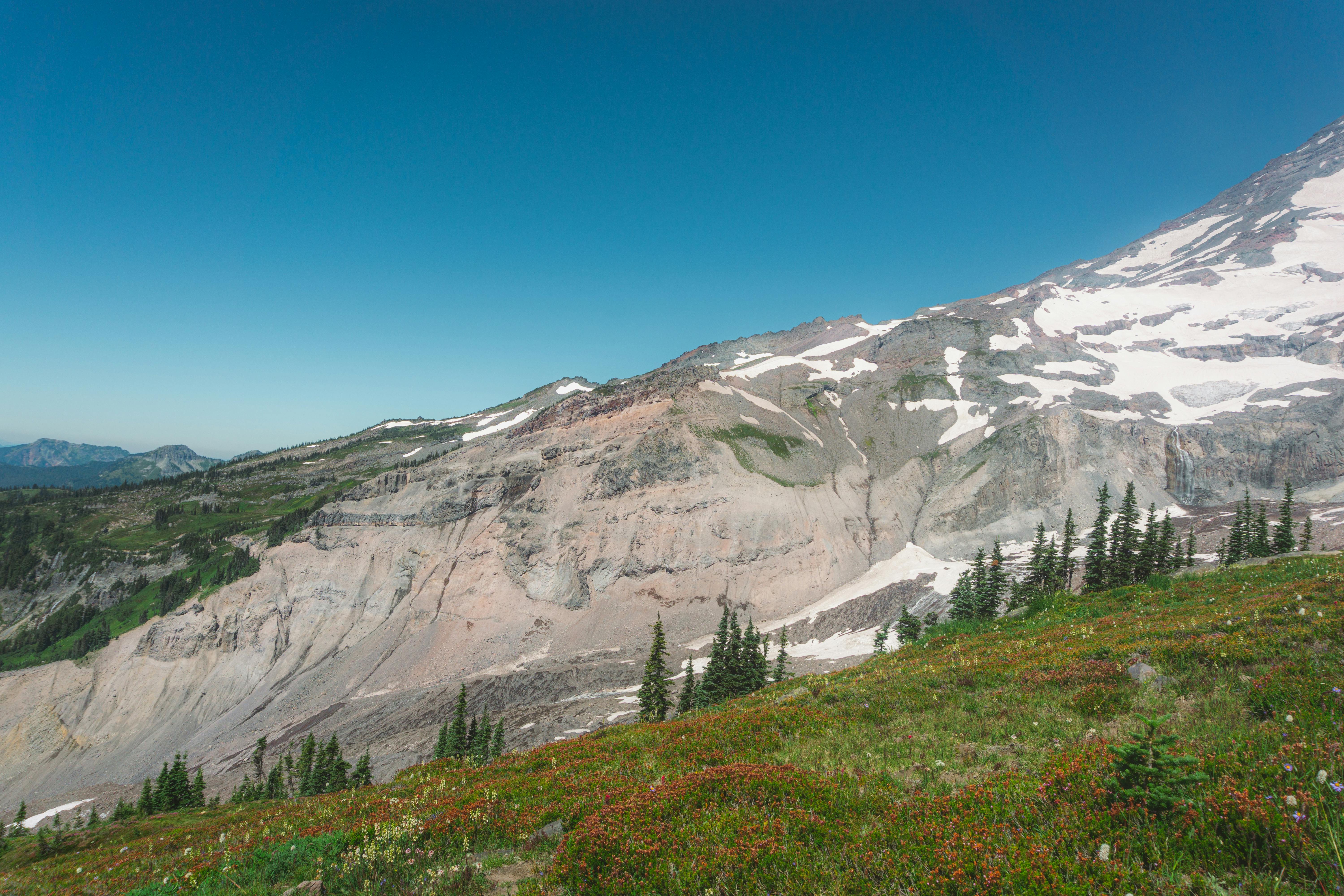
Ptarmigan Ridge in the Mount Baker-Snoqualmie National Forest is one of the clearest examples of a forest trail rivaling a household-name park hike. The Forest Service says the route begins at Artist Point in the Mount Baker Wilderness and delivers views stretching from Mount Rainier to Canada on clear days, with marmots, pikas and mountain goats commonly spotted along the way.
The route follows Chain Lakes Trail before splitting onto Ptarmigan Ridge, where hikers move toward Coleman Pinnacle and, farther on, Camp Kiser. Forest Service descriptions note lingering snow can persist into August or September, making late summer and early fall the preferred season. Vehicles at the trailhead require a recreation pass, but no hiking permit is required for a standard day trip.
What makes the trail stand out is the concentration of alpine drama. Instead of a single marquee peak framed from one overlook, hikers get a moving panorama of glaciated volcanoes, lava cliffs and high meadows. In practical terms, it offers the visual scale many travelers chase at heavily photographed Mount Rainier viewpoints, but with a route that feels more exploratory than curated.
2. Middle Fork Trail, Washington, as a quieter answer to Olympic rainforest fame
In western Washington, the Middle Fork Trail 1003 in Mount Baker-Snoqualmie National Forest offers a different kind of alternative: old forest, river sound and deep valley travel without the same name recognition as Olympic National Park’s famous rainforest walks. The Forest Service says the trail crosses an arched beam cable-hung bridge and then follows a mix of path and 1930s-era railroad grades.
The route passes mature second-growth forest with remnant old-growth trees and snags, while occasional openings reveal Garfield Mountain and the Middle Fork Snoqualmie River. The trail extends for miles, with a spur at mile 5.8 leading toward Dingford Creek. Nearby access also connects to the Pratt River Trail, making the area useful for longer custom itineraries.
For hikers, the appeal is texture rather than spectacle. Moss, river cliffs, giant conifers and industrial history combine into a landscape that feels lived in and wild at the same time. Travelers who head to Olympic for immersive forest atmosphere often find a similar sensory experience here, but with more route flexibility and fewer of the expectations attached to a national park headline stop.
3. Green Lakes, Oregon, beyond the crush of the Three Sisters’ celebrity routes
The Green Lakes corridor in Deschutes National Forest is not exactly unknown, but it remains overshadowed by Oregon’s more famous summit pushes and long-distance trail segments. The Forest Service describes the Green Lakes/Soda Creek Trailhead as a heavily used access point into the Three Sisters Wilderness, and the area now requires wilderness permits for both day use and overnight stays from that trailhead.
That management change is itself a sign of demand. The Three Sisters Wilderness contains a 40-mile segment of the Pacific Crest National Scenic Trail, and federal managers say the permit system is intended to protect a landscape easily reached from major population centers in central and western Oregon. Nearby alternate access points, including Crater Ditch and Six Lakes, show how broad the trail network remains even as some entry points tighten.
Green Lakes earns its place because it combines immediate payoff with big-mountain context. Hikers move from forest into lava-shaped terrain and lakes beneath the South Sister massif, with broad volcanic views that compare favorably with many of the Northwest’s most publicized day hikes. It is the kind of trail where permit demand has risen precisely because the scenery long ago outgrew its “local favorite” label.
4. Eagle Cap approaches, Oregon, for alpine lake seekers priced out by fame
Northeast Oregon’s Eagle Cap Wilderness has long been respected by backpackers, but it remains underrepresented in mainstream travel coverage compared with the marquee parks and ranges of the northern Rockies. The Forest Service says the wilderness contains about 535 miles of trails and is the most heavily used wilderness in that part of the state, with the Lakes Basin Management Area the most popular zone.
Several trailheads provide access, including Wallowa Lake, Main Eagle and Huckleberry. Forest pages for the area describe routes that open onto ridges, lake basins and broad valleys framed by granite peaks. All wilderness visitors are required to obtain a wilderness visitor permit before entering, though the system is generally less intimidating than the quota structures associated with many famous park trailheads.
What stands out here is the density of options. Rather than one canonical hike, Eagle Cap offers an entire mountain system of linked choices: lakes, passes, creek valleys and wildlife habitat. For travelers drawn to the idea of the Tetons or Glacier but seeking a more self-directed experience, the Wallowas supply the same alpine ingredients—water, granite, elevation and long views—without being reduced to one overcrowded viewpoint.
5. Wind River Highline, Wyoming, in the shadow of Grand Teton
Wyoming’s Bridger-Teton National Forest and adjacent public lands hold some of the most ambitious non-park hiking terrain in the country, yet many first-time visitors still default to Grand Teton National Park. The Forest Service’s Highline material for the Wind River Range describes a route beginning near Green River Lakes and climbing from roughly 8,000 feet toward far higher alpine country, with sweeping views and wildflower habitat.
The nearby Shoshone National Forest, meanwhile, notes that the Popo Agie Wilderness in the Wind River Range includes the Cirque of the Towers area and carries extra camping setbacks near Lonesome Lake. Together, those management notes point to an important reality: these trails are no secret to experienced users, and they demand real planning, navigation awareness and respect for fragile alpine basins.
Still, the comparative advantage is obvious. Grand Teton offers world-famous scenery and easy access, but the Winds deliver scale on a different order—longer approaches, bigger route combinations and a feeling of entering an entire mountain interior. For fit hikers and backpackers, these forest and wilderness routes often surpass the neighboring park in immersion, even if they require more commitment from the outset.
6. Arizona’s Highline, a rim-country counterpoint to Grand Canyon fame
Arizona’s Highline Trail in Tonto National Forest is less about replacing a canyon icon than broadening what visitors think Arizona hiking can be. The Forest Service says the trail runs roughly east to west below the Mogollon Rim, ties into several routes for loops, and spans more than 50 miles. It is also part of the 800-mile Arizona National Scenic Trail.
The agency notes that the route, established in 1870, once connected homesteads and served school travel. In 2022, officials made what the Forest Service called a substantial commitment to rerouting and rebuilding sections for sustainability and a better user experience. Those investments matter in a state where many travelers focus overwhelmingly on Grand Canyon overlooks and corridor trails.
The Highline’s appeal lies in range and contrast. Instead of descending into one monumental chasm, hikers traverse rim country marked by ponderosa pine, rock formations, brushy hills and broad canyon views. It offers history, endurance value and ecological variety in a single corridor. For travelers who leave Arizona thinking only of one park, the trail is a reminder that the state’s most compelling walking landscapes are not confined to one canyon.
7. San Juan Highline Loop, Colorado, away from marquee fourteener traffic
Southwest Colorado’s San Juan National Forest has no shortage of famous peaks, but many hikers still organize trips around fourteener checklists or the busiest slices of the Colorado Trail. The Forest Service says the Highline Trail, part of the Colorado Trail, travels through aspen, spruce-fir forest and alpine terrain, while the linked Highline Loop National Recreation Trail can be accessed at Kennebec Pass.
Agency figures place the one-way Highline segment at 19 miles, with elevations running from about 9,200 feet to more than 12,000 feet along the loop. Because it links multiple trails—Sharkstooth, Bear Creek and Grindstone among them—it offers serious day-hike and backpack options without forcing visitors onto the state’s most publicized summit routes.
That matters in Colorado, where popularity can flatten experience into a parking contest. The San Juan high country remains one of the state’s richest combinations of color, altitude and geology. On this loop, hikers trade the social ritual of bagging a single famous peak for a broader mountain traverse that better showcases how the San Juans actually work as a landscape: layered, expansive and constantly changing with weather and elevation.
8. Uinta Highline, Utah, for those who want distance beyond Zion’s bottlenecks
Utah’s tourism identity is still dominated by its national parks, especially Zion, where shuttle operations and visitation pressures shape much of the visitor experience. Far to the northeast, the Highline Trail #105 in the Uinta-Wasatch-Cache National Forest presents a different proposition. The Forest Service says the route traverses the Uinta Range west to east, covers roughly 96 miles, and spends much of its course above 10,000 feet in the High Uinta Wilderness.
The trail runs between the Hayden Pass area near Mirror Lake Highway and Highway 191, with a shorter option near Chepeta Lake. Maximum elevation reaches 12,700 feet, according to the Forest Service. This is not a casual substitute for a park boardwalk; it is a committing mountain route where weather, altitude and remoteness shape every decision.
Yet that is exactly why it has become more appealing to experienced hikers. For travelers who love Utah but want the state’s alpine side rather than its most photographed sandstone narrows, the Uinta Highline offers a nearly continuous immersion in lakes, passes and tundra. It outshines famous neighbors not by being easier, but by revealing a completely different Utah that many visitors never see.
9. The permit era is redefining what counts as “underrated”
One of the clearest findings from federal trail management is that “underrated” no longer means empty. Desolation Wilderness in Eldorado National Forest now requires permits for overnight camping and even day visits year-round, with quotas in place for overnight destination zones from the Friday before Memorial Day through September 30. In Oregon’s Central Cascades, permit systems cover all overnight use and some day use at major trailheads.
Those rules are not evidence of failure. They are signs that national forests and recreation platforms are being used to protect sought-after places before they tip fully into overuse. The same trend shows up in Yosemite and other parks, where wilderness permits and trailhead quotas are designed to preserve solitude and reduce impacts in heavily visited backcountry.
For readers, the implication is straightforward. The best alternatives to famous trails are increasingly those with some structure around them: permits, seasonal timing, or trailhead planning. That does not diminish their appeal. If anything, it confirms these routes have graduated from insider secret to nationally relevant destination while still delivering the very qualities—space, quiet and landscape scale—that made them special in the first place.
What hikers should take from the new map of Western trail travel
The most important change is conceptual. National forests are no longer just the drive-through lands between named parks. They are, in many cases, the main event: the place where the same mountain systems open up into more varied, less scripted and often more ambitious trail experiences.
That shift also broadens who gets to have a memorable trip. A family may find a shorter ridge or lake walk outside a famous park easier to access. A strong day hiker may choose a forest trail with equivalent scenery and less traffic. A backpacker may discover that the route with the deepest sense of wilderness lies outside the park boundary altogether.
The nine trails and trail systems highlighted here are not superior in every circumstance, and none should be mistaken for easy. Snow, fire closures, wildlife, permit rules and altitude all matter. But together they illustrate a larger truth emerging across the American West in 2026: the most rewarding hike is often not the one with the biggest name, but the one next door.