
Mount Rainier National Park is a wonderland of waterfalls and wildflowers surrounding one of the most majestic mountains that you will ever see.
Even though we consider ourselves skilled hikers, these easy hikes in Mt Rainier are a must-see and perfect for beginner hikers as well.
-
-
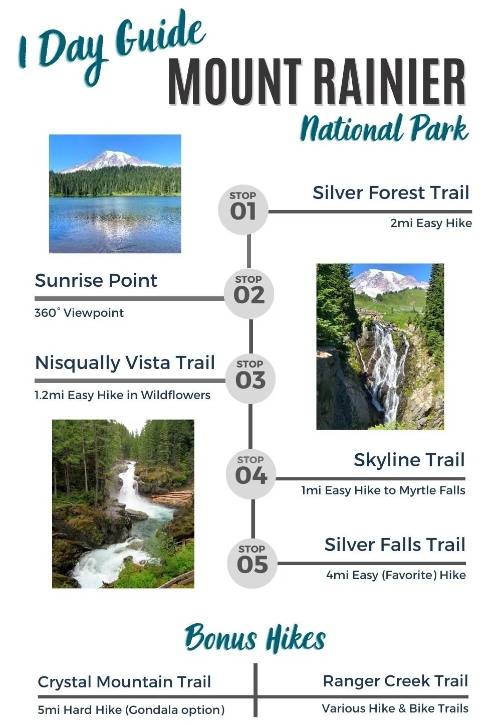
Best Mt Rainier Easy Hikes
-
Mt Rainier Map – Hiking Trails
-
Itinerary: 1-2 Days in Mt Rainier
-
Pro Tips – Hiking in Mt Rainier
-
Easy Hikes in Mt Rainier
Below you’ll find our five favorite hikes in Mount Rainier that also happen to be beginner-friendly.
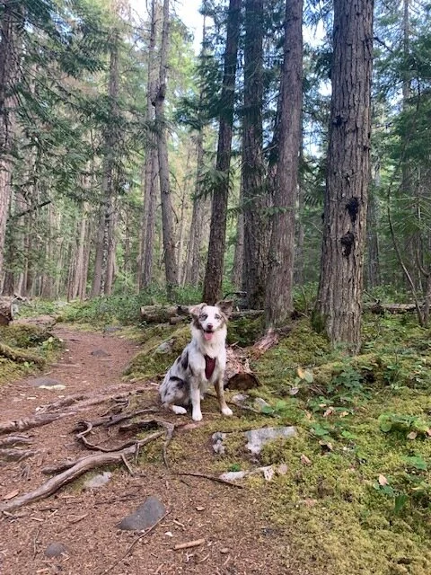
Always check the current weather and road conditions before your trip. Also, note that none of these trails are dog-friendly.
1) Nisqually Vista Trail
Region: Paradise
Hiking distance: 1.2 mile loop
Trail Map
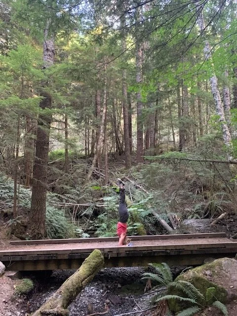
Nisqually Vista Trail is a flat and easy loop trail. The path is paved the entire way allowing the whole family to enjoy this stroll. Nisqually Glacier is visible from the viewpoint on clear days. People come for the glacier, but they stay for the wildflowers. If you are there in July or August, you will be treated to one of the most colorful displays I have ever seen in nature.
While adventure junkies might be tempted to skip this short loop, we were so happy that we decided to try it out. The full loop only takes 30-45 minutes, so why not?
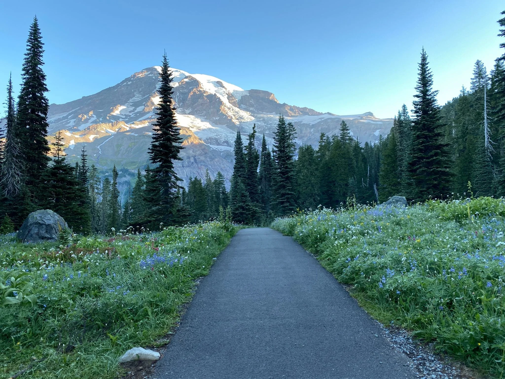
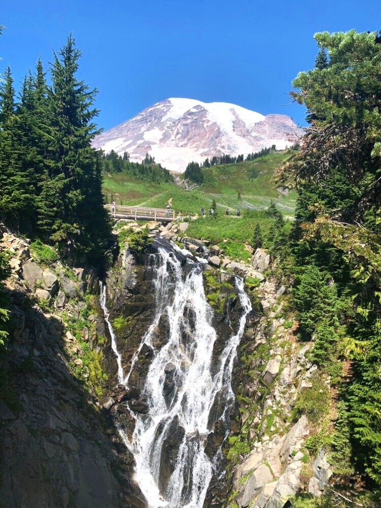
2) Skyline Trail to Myrtle Falls
Region: Paradise
Hiking distance: 1 mile (out and back)
Trail Map
Skyline Trail is another short and flat hike that is easy for nature lovers of all ages. Myrtle Falls is only a half mile down a paved path.
While the trail was crowded on an August afternoon, Myrtle Falls was my favorite viewpoint in the park I found myself spinning in circles trying to soak in the waterfall surrounded by wildflowers of all colors. Don’t miss this short and sweet treat.
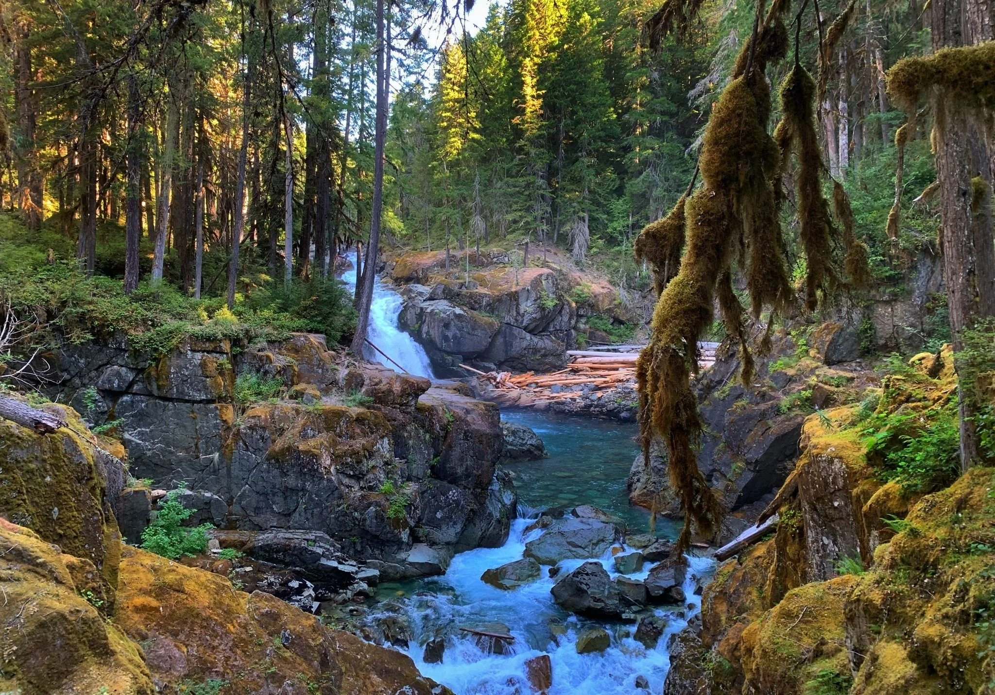
3) Silver Falls Trail
Region: Paradise/Ohanapecosh
Hiking distance: 3-mile roundtrip loop
Trail Map
Silver Falls is a beautiful 40-foot waterfall that crashes into an ice-blue pool.
And if you’re up for the cold plunge, there are a few spots where you can scramble down to the water to take a very cool dip on a hot day.
You can park at the south end of the trail at the Ohanapecosh Visitor Center or at the north end of the trail by the Grove of the Patriarchs Trailhead (access to Silver Falls Trail is right across the street via Eastside Trail).
This mostly flat hike winds through a mossy forest along the Ohanapecosh River. Of the trails that we hiked in the park, this was my favorite easy hike.
4) Shadow Lakes Trail
Region: Sunrise
Hiking distance: 2.8 miles (out and back)
Trail Map
Sunrise Rim to the Shadow Lake is a great easy hike to start your day. The trail is flat and a great way to get your body warmed up.
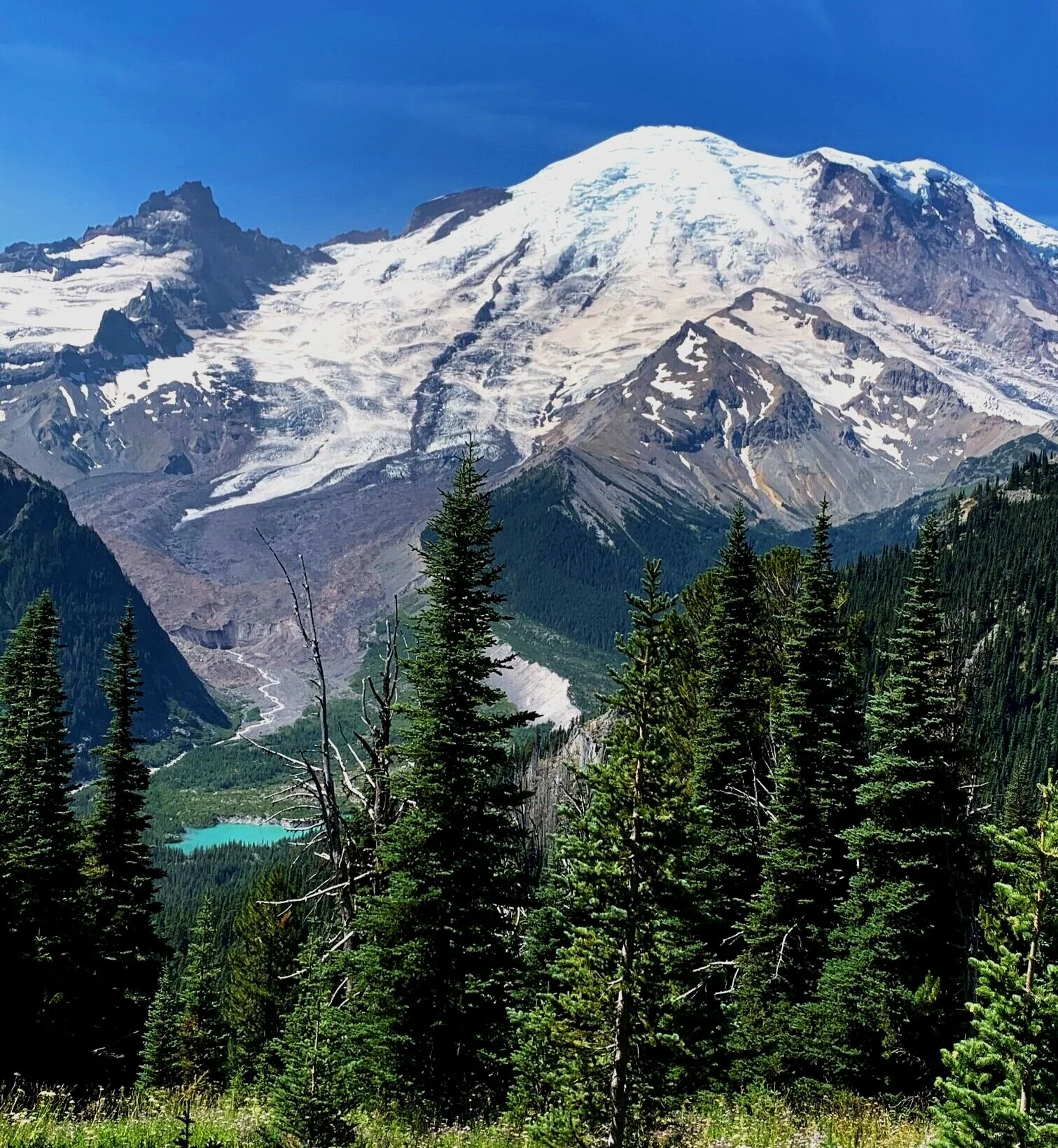
The main attraction of the hike is walking through fields of wildflowers while admiring breathtaking views of the Emmons Glacier (the largest glacier in the USA outside of Alaska).
The trail winds through wildflower meadows and evergreen groves. Every so often, Mount Rainier bursts through a clearing resulting in fantastic photo ops. On clear days, you can see the teal Shadow Lake at the base of the mountain.
I could not stop smiling on this hike. The early morning sun hitting Mount Rainier will forever be etched into my brain. While many people skip the Sunrise Region for the more popular Paradise Region, this hike makes the added miles worth the drive.
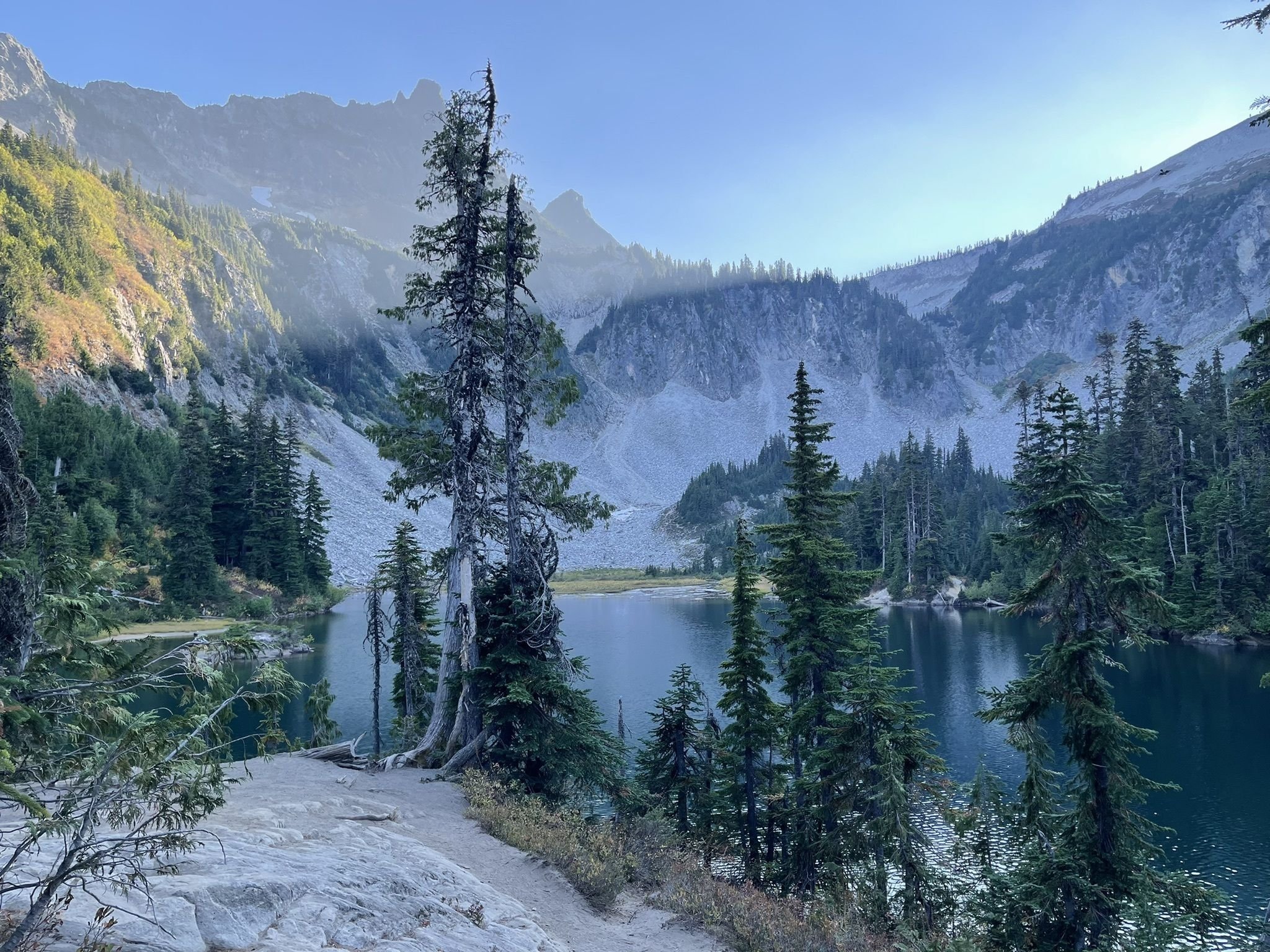
5) Bench and Snow Lakes
Region: Paradise Area
Hiking distance: 2.2 miles (out and back)
Trail Map
One of the more underrated and lesser-walked trails in the park is to see the two beautiful subalpine lakes: Bench and Snow Lakes. The trail is short but steep in a few places that will give your thighs a good workout.
At Bench Lake, the reflection views of Mount Rainier are incredible, even better than those at “Reflection Lake.”
When you get close to Snow Lake, go left at the toilet sign instead of right to Snow Lake. The views are even more spectacular and you can see the entire lake and the mountains climbing up behind the lake from one of the campsites.
Mt Rainier Map – Hiking Trails
You can click the links below to download the hiking trails for each area of the park.
-
Sunrise Area Trails Map: Emmons Vista, Sunrise View, and Shadow Lakes Trail
-
Paradise Area Trails Map: Nisqually Vista Trail, Myrtle Falls, Bench and Snow Lakes
-
Ohanapecosh Area Trails Map: Silver Falls Loop Trail
Itinerary – Hiking Mt Rainier
Pro Tips – Hiking in Mt Rainier
Best Time to Visit Mt Rainier —
The most ideal time to hike in Mt Rainier is during the summer months of July and August when there is less precipitation, wildflowers are blooming, and temperatures peak around 60-70°F.
Keep in mind that snow will remain on the ground in elevations higher than 5000 feet until mid-July. Year-round you can expect a cool and rainy climate.
The wildflowers in Mt Rainier start blooming in July and last throughout August. The park can be pretty busy during that time, but seeing all of the colors is worth dealing with the crowds.
Hiking Gear for Mount Rainier —
Mount Rainier creates her own weather and it changes very quickly. Make sure you wear layers. Additionally, higher elevation parts of the park are chilly throughout the summer.


We use affiliate links for products we recommend and, at no extra cost to you, it helps us earn money to support our blog!
-
Rain jacket: A water-proof, wind-proof jacket like the women’s REI GTX and men’s OR Foray are ideal.
-
Hiking shoes: the mens and womens Altra Lone Peaks are our favorite
-
Hydration Pack: a 15-20L backpack is ideal for day hikes
-
Sunscreen: the UV rays are intense this high in elevation
-
Heavy-duty Bug Spray: a must for this area
-
Electrolytes: we swear by this no sugar mix to help prevent dehydration from high altitude
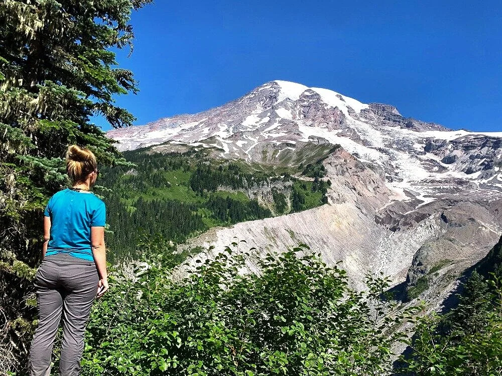
Sunrise Area vs Paradise Area – Mt Rainier
Paradise is the most popular part of the national park and the best place to see the wildflowers in the summer.
If you only have time for one area of the park, we recommend going to Paradise area as there are more hiking trails that you can easily complete in one day.
It is possible to explore both areas of the park in one day, but you’ll need to start early and plan a 1-2 hour drive between regions. If going to both areas, start at the Sunrise Area.

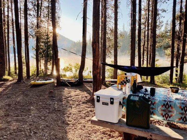
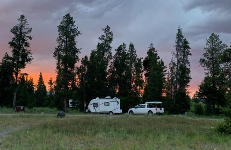
Free Camping near Mt Rainier —
Ranger Creek Airstrip is one of my favorite free campsites that we have ever stayed at! It’s a couple of miles north of Crystal Mountain.
There is a never-ending web of hiking and mountain biking trails that surrounds the camping area.
The road in is ¾ mile on rutted gravel, but we saw a Prius and large RVs make it just fine. A ranger may enforce you have the Washington Discover Pass ($35/year) to camp here.
Best Hikes near Mt Rainier
We stayed in the Mount Rainier area for a week, and some of our favorite trails were outside the park and dog-friendly.
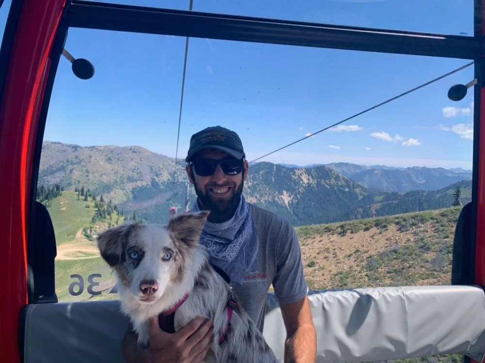
Crystal Mountain Trail (Mt Rainier Gondola)


Hiking distance: difficult 5 miles (one way)
Elevation Gain: 2,559 ft elevation (option to ride the gondola up or down)
Trailhead: 33914 Crystal Mountain Blvd, Enumclaw, WA 98022
Trail Map: we walked Silver Creek Trail to Summit House where we rode the gondola down
Dogs allowed: yes and on the gondola
Crystal Mountain Resort is a beautiful ski resort 6 miles north of the national park on SR 410. In the summer, Crystal Mountain is a hiker’s paradise.
The main, fully enclosed gondola operates during the summer at a reduced price. Tickets were $25/person when we went, and dogs are free. They give you a $10 discount if you hike to the top and ride the gondola down, which is what we did.
There is also a disc golf course going down from the summit if you want to add a little something extra.
The significant elevation gain makes this hike a burner! Even Arya (our dog) was tired at the top.
If you start at the bottom, you will want to look for Silver Creek Trailhead to the left of the lower gondola area. The initial ¼ mile is steep with no shade, but you enter the cool forest before too long.
The trail winds through lush forest with wildflower meadows and creeks scattered along the way.
About halfway, the trees clear for Hensen Lake. We walked the full circle around the lake while Arya swam and played with sticks. Hensen Lake is a good place to take a break and rest your feet. On the far side of the lake, you will reach the Crystal Mountain Trailhead.
The initial part of the Crystal Mountain Trail is relatively easy. As you go up, the trees start to thin out. The last ½ mile at the top is very steep with little shade, but you are rewarded with stunning views of Mount Rainier and Mount Saint Helens in the distance.
The summit is a great spot to enjoy some grub. There is a small store that has food and drinks as well as lift tickets for the way down.
Taking a gondola down after a difficult hike is a fantastic treat, and I would highly recommend this option.
Hiking distance: choose your own adventure
Trailhead: Trail Map
Dogs allowed: yes
We stayed next to this trailhead in dispersed camping at Ranger Creek Airstrip. If you are just coming for the trail, park at the trailhead for Skookum Flats so you don’t have to go too far down the bumpy backroad.
If you are a hiker, I recommend taking the trail northwest from the parking lot and parallel to the White River as this is a narrower and windy trail that you won’t find many bikers on and I think it has prettier views.
If you want to ride, I suggest going South on the trail from the parking lot. About a half mile in, you will end up seeing the open space for campers and the airstrip. From here you will find the better mountain bike trails along the southwest end of the airstrip.
Either route you take, you will have soft dirt trails through the mossy forest. Our dog was always with us and loved drinking from the glacial creeks that cross the trails.
read next —


Share this blog post!


I liked your blog thanks for sharing this.
thank you! I hope you have a great time hiking in Mt Rainier!
Fun read!