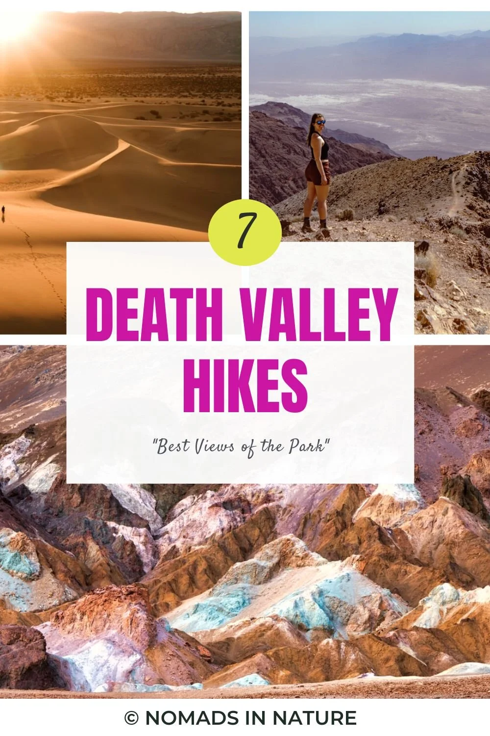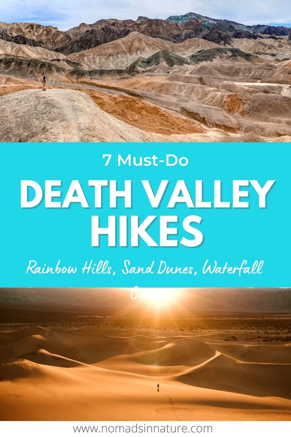
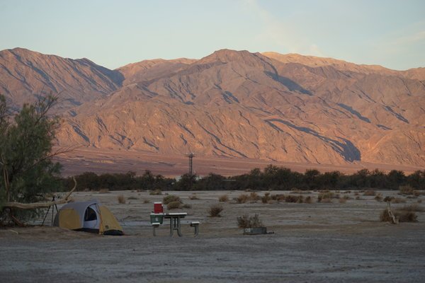
The hikes in Death Valley National Park are out of this world. You would never guess that the best hikes in Death Valley encompass everything from sand dunes, rainbow-colored hills, a crater, and even a desert oasis with a waterfall.
Death Valley National Park is over 3 million acres, putting it as the fifth-largest national park in the United States (behind four Alaska national parks).
Be sure to also view our list of 9 iconic things to do in Death Valley and where to stay in Death Valley.

Best Death Valley Hikes
From easy to difficult, and very popular to very remote, these are the hiking trails in Death Valley National Park with the best views that will be sure to leave a lasting impression on you!
1) Dante’s Ridge View Hike

Hiking distance: variable 1-9 miles (out and back)
Difficulty: Easy to Moderate
Hiking Route: All Trails
One of the most expansive views of the national park and Badwater Basin is from the lookout at Dante’s View.
You can easily drive the paved road up to the parking lot that puts you front and center of Dante’s View, but for the real camera-worthy shots you’ll want to take the trail up the ridgeline.
If you’re looking out from the parking lot to the view, the trail to the left only goes 0.4 miles and the views aren’t that much better than what you see from the parking lot.
If you go toward the trail on the right, you will be heading uphill toward Mt Perry.
This trail is 4 miles out to Mt Perry and is moderately grueling, but you don’t need to go the entire way to get some epic views. I recommend at least hiking up the first quarter mile to see the entirety of the Badwater Basin and the colorful surrounding mountains.
Fun Fact – the pools of water you see below are formed by the hidden underground Amargosa River. This river is 185 miles in length and only surfaces when it encounters solid rocks.
At one point during the last major Ice Age 10,000 years ago this river also connected to the Colorado River Delta.
2) Twenty Mule Team Canyon

Hiking distance: 0.5 mi (out and back)
Difficulty: easy
Hiking Route: All Trails
I’m not sure if the drive through Twenty Mule Team Canyon or the view is more epic but either way, this is one of my top 3 attractions in Death Valley!
The road to Twenty Mule Team Canyon is a one-way 2.5-mile road and shortly after the trailhead stops around 2 miles you will see why it is one way!
The road becomes very windy and narrow with steep roller coaster style hills, which of course made the drive even more fun (and slightly nerve-racking).
The National Park website states that most cars are fine to drive on this road except for those with especially low clearance.

You will drive about 2 miles down Twenty Mule Team Canyon Road before you get to the “trailhead.”
There is enough parking for only a handful of cars and you will see a faint trail to your right going up the hill.
Climbing up the hill for a quarter mile, we found the most otherworldly views of the vast and multi-dimensional hills of Death Valley.
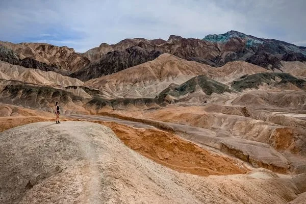
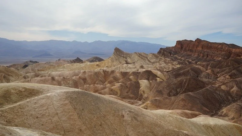
3) Red Cathedral and Manly Beacon
Hiking distance: 4.4 mi roundtrip
Difficulty: Moderate
Hiking Route: All Trails
The views from Manly Beacon are expansive and worth the climb!
There are various routes in this area, but I encourage you to take the route to Red Cathedral and Manly Beacon as these are the highlights of the trail.
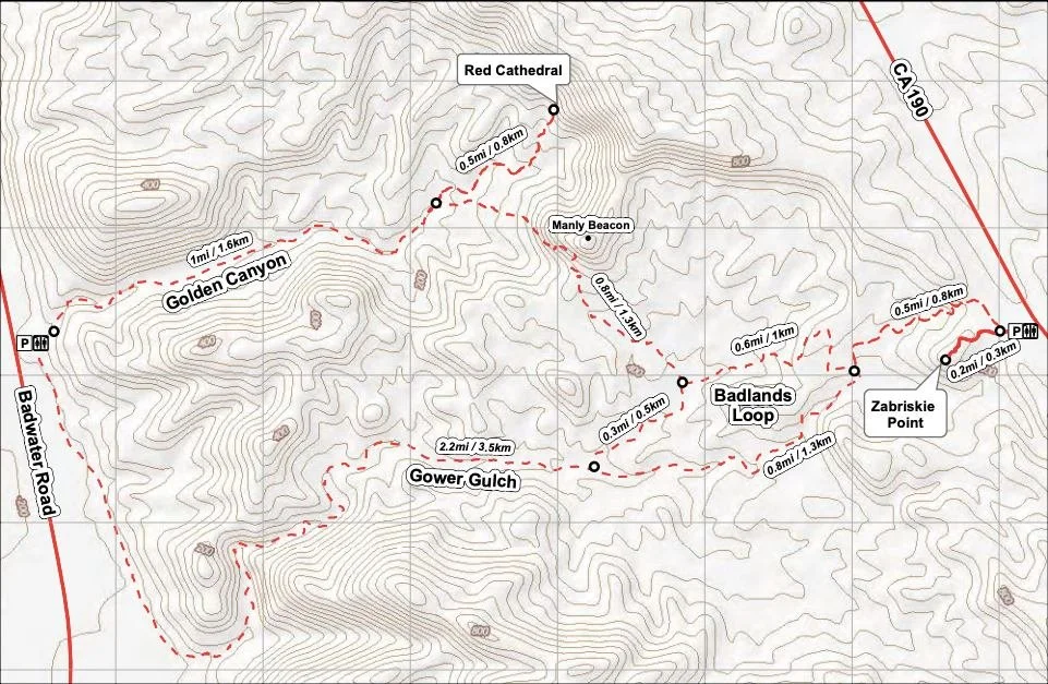
This trail is exposed to the sun so you will want to start at sunrise and bring at least 2.5L of water. Keep in mind that sunrise at Zabriske Point is one of the most popular things to do in Death Valley.
Start by hiking counter-clockwise through the Badlands Loop and then go right at the split towards Manly Beacon and Red Cathedral.
Be aware that at points along the Badlands Loop can be a serious sandy hill climb and narrow path.
![]()
Next, you will want to head to Red Cathedral as this is the best part of the entire loop! The short, yet steep half-mile trail up to Red Cathedral can be sketchy for some but for experienced hikers with good traction shoes you should be fine.
Once you’ve taken in the epic views of Red Cathedral, head back town and from here you can decide if you want to continue and do the full loop through Golden Canyon and Gower Gulch, or backtrack and continue on the Badlands Loop.
I suggest backtracking until you back to the Badlands loop and then taking the fork to see the Gower Gulch for at least a quarter-mile before turning back to the Badlands.
The end of Gower Gulch is the best part and they have some cool caves and colors to experience, but I don’t think it is necessary to hike the entire length of the Gower Gulch.
Definitely plan to download the All Trails map for offline use since you will not have a signal in this area and there are a lot of forks along this trail.
4) Ubehebe Crater Loop Hiking Trail

Hiking distance: 2.2 mi loop
Difficulty: easy
Hiking Route: All Trails
If you’ve never seen a crater before or love seeing craters, don’t pass up Ubehebe Crater on the north side of the park in Death Valley.
Ubehebe Crater is the largest and youngest of a dozen craters in the Ubehebe volcanic field. It is estimated to be 2,100 years old, a 0.5 mile in diameter, and ranges from 500-777 feet deep.
It is just over an hour drive from the Furnace Creek Visitor Center and is a must-see if you are already planning to see the mysterious rocks at Racetrack Playa.
From the parking lot, you can see a good amount of the crater, but I recommend doing the easy loop around so you can also see Little Hebe Crater.
If you’re up for the difficult challenge, you can also hike down into the crater, but remember, it is a steep and difficult climb up on ankle-deep debris.
The perfect time to view Ubehebe Crater is during sunset when the colorful layers of the sedimentary rock form a deep contrast and photograph beautifully.
5) Darwin Falls – Death Valley Hike

Hiking distance: 1.9 mi total (out and back)
Difficulty: easy
Hiking Route: All Trails
Oddly enough, to add to the multi-dimensional terrain of Death Valley, there is a little oasis with a waterfall from November to May.
Located 2.5 miles off Hwy 190 near Panamint Springs in Death Valley National Park is the trailhead to Darwin Falls. It is a 45-minute drive from Stovepipe Wells.
Old Town Road is a semi-rough unpaved road for 2.5 miles before getting to the parking area, but most vehicles should be able to drive on this road.
Note, there is no sign for the trail off the main road so make sure you have the All Trails app taking you to the trailhead and have the route downloaded for offline use while you still have a signal.
The first 3/4 mile is along a stream bed and then you enter the lush trees and flowing stream.
There is a place where it looks like the trail stops by a large rock, but it doesn’t. Scramble up the rock and go 50 yards for the waterfall!
Please do not swim in this water as it is a fragile resource and can be easily damaged by human interaction.
6) Artists Palette (Rainbow Hills)

Hiking distance: 0.3 miles
Difficulty: easy
Hiking Route: All Trails
For the most captivating and incredibly beautiful views, you have to see Artists Palette toward the end of Artist Drive.
The best time to visit Artists Palette is during sunset. To see the colors pop, you will want to stay for “blue hour” when the sun goes down and the last remains of light allow the pinks, blues, and greens to pop!
This unusual rainbow coloring of the mountains is formed by volcanic deposits rich in compounds such as iron oxides and chlorite.
Once you get to the parking lot, it is up to you where and how far you want to descend into the Rainbow Hills as there is no official path or trail.
Be sure to bring a headlamp if you do plan to stay for blue hour.
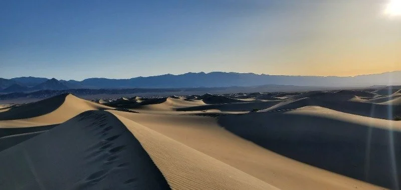
7) Mesquite Sand Dunes Hiking
Hiking distance: 2 mi total (out and back)
Elevation Change: 185 ft (to the tallest dune)
Hiking Route: All Trails
The Mesquite Flat Sand Dunes are the most accessible sand dunes in Death Valley National Park, and therefore also the most popular dunes.
I highly recommend visiting the sand dunes for sunrise when there is barely anyone else there and no footprints besides yours and those of nocturnal animals.
There is no formal trail, but you can follow the All Trails route or just go and explore as you wish to find more remote and majestic views.
You can also sand surf here which is a ton of fun for the entire family!
Don’t forget to wear sunscreen, a hat, and a neck gaiter in case the winds pick up.
If you want to experience some of the most amazing sand dunes then consider the distant drive to Eureka Sand Dunes to see the tallest dunes in North America.
Map – Death Valley Hiking Trails
Click the icons on the map for information about each point of interest.
Death Valley Hikes – Honorable Mentions
-
Grotto Canyon: for those who love doing moderate-level rock climbing, consider checking out this 2-mile out and back hike that is only 5 minutes from Stovepipe Wells.
-
Telescope Peak: if you are ready to hike the 14 miles to the tallest mountain peak in Death Valley, sitting at 11,049 feet, this is the hike for you! From the peak, you can see 360 views of Death Valley including the lowest point in the U.S. (Badwater Basin) and the tallest point in the U.S. (Mt Whitney).
-
Room Canyon: if you want to go off the beaten path and explore what looks like a slot canyon in Utah, then I’d recommend heading out to Room Canyon. It is an hour’s drive south of Furnace Creek Visitor Center. Pay attention to the All Trails reviews to know exactly where to park and find the slot canyon.
Best Time to Hike Death Valley
The best month to hike Death Valley is in March when the temperatures average a high of 80°F and a low of 55°F, additionally, the wildflowers blooming towards the end of the month are a rare and iconic sight to see.
If you can’t visit in late March to early April, at least avoid the months of May to September as daily temperatures average over 100°F and dehydration is severe.
If you do plan to hike in the summer months, make sure you are starting by sunrise at the latest and bringing at least 1L more water than you think you’ll need and another gallon jug of backup in your car.
Hiking Essentials – Death Valley
-
Hydration Pack: a 20L backpack is ideal for day hikes.
-
Extra Water: We filled up our collapsible 5 gallon jug and left it in the trunk for emergencies as dehydration is a common cause of death here.
-
Hiking shoes: the mens and womens Altra Lone Peaks are our favorite.
-
Electrolytes: we swear by this no sugar electrolyte mix to help prevent dehydration.
-
Sun Hat: this is the perfect hiking sunhat
-
Sunscreen: Coola is incredible for sweaty hikes.
-
Safety Items: ultralight First Aid Kit, a LifeStraw, multi-tool, and a survival blanket.
-
Battery Pack: It is always good to have a backup charger that can be charged by the sun.
-
Quick-energy: Honey Stingers give the best clean and quick fuel.
-
Spare Tire and Jumper Cables: a flat tire is VERY common here. Be prepared as there is little to no cell service and a tow is hours away. This device has a battery to jump-start your car and air up your tires.
We use affiliate links for products we recommend and, at no extra cost to you.
read next —


Save this post for later!